Field use best practice
The DA2 GNSS receiver is a high‑precision GNSS device. Following these best practices will help ensure that you achieve maximum possible precision and performance.
Attach the antenna correctly
To optimize accuracy, ensure that DA2 is correctly attached to your survey pole. When installed correctly the antenna will be flat and should completely conceal the yellow thread adapter.
|
|
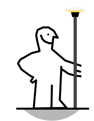
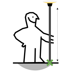
Mount the antenna above head height
The DA2 requires a clear and unobstructed view of the sky so that the antenna can track the signals from GNSS satellites. Mount the DA2 on a pole to elevate the antenna above head height so that it is not obstructed by your body or other nearby objects.
|
|
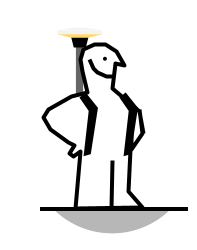
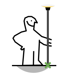
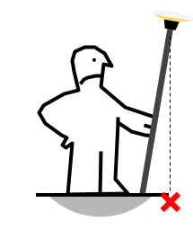
Keep the antenna pole vertical
The DA2 will measure the exact position of the antenna. If you are attempting to map or survey a point on the ground, make sure that your pole is as vertical as possible using a level bubble.
|
|
Set the antenna height in your field software
By default, the DA2 will report positions relative to the bottom of the antenna push-fit mount. If you are using a pole, enter the height of the antenna from the bottom of the push-fit mount to the ground in your software’s antenna offset field to ensure that your software is recording accurate heights.
|
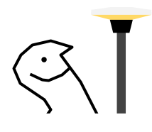
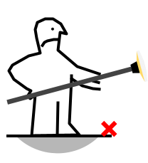
Carry the antenna upright
Maintain good antenna orientation between points of interest by carrying the antenna upright, rather than at your side. Pointing the DA2 antenna away from the sky while in use will reduce the number of satellites that can be tracked or may introduce poor/reflected GNSS signals into the position solution. This can lower GNSS performance, or interrupt positioning, which will slow you down and reduce your data quality.
|
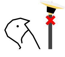
Take care when working around trees and buildings
GNSS technology requires direct line-of-site to GNSS satellites for optimum performance. Trees and buildings obstruct and reflect GNSS satellite signals which can lower performance and introduce errors. Trimble ProPoint technology and the design of the DA2 receiver mitigates these challenges, but you should still take care when working with GNSS near trees and buildings.
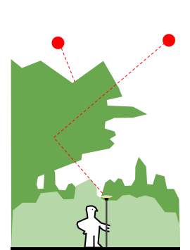
|
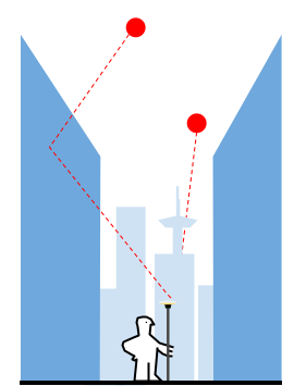
|
Pay close attention to the precision estimate in your field software, and if necessary take more time in obstructed environments to allow the receiver to converge on a high-precision solution, before logging a point. If you notice that the precision estimated by the receiver increases significantly, try moving to a more open environment to allow the precision to recover, to an acceptable level.
