2020.00
Version 2020.00 of the Trimble Access software was released in May 2020. To download these release notes as a PDF file, click this link.
These Release Notes describe the new features and changes available in this release of the Trimble® Access™ software.
New features
Trimble Access is now available on Android
Trimble Access version 2020.00 supports the Trimble TDC600 handheld, an ultra-rugged smartphone running the Android™ 8.0 operating system. The TDC600 handheld features a high resolution 6‑inch display, 4 GB RAM and 64 GB internal storage.
The Trimble Access Roads app is supported when running Trimble Access on the Trimble TDC600 handheld. We are working on supporting more apps.
Install Trimble Access to the TDC600 using Trimble Installation Manager for Android. For more information, see Installation information.
Trimble Access supports using the TDC600 in portrait mode or landscape mode. There are small differences in the UI to accommodate portrait mode. These are:
- To view a form as well as the map, tap
 and swipe down to view more of the form, or tap and swipe up to view more of the map.
 - To view more softkeys, tap
 or swipe right to left along the row of softkeys.
 - There is no Esc softkey when Trimble Access is running in portrait mode. To exit a screen without saving any changes, press the Back key on the device.
The TDC600 can connect to all supported GNSS receivers and most conventional instruments using Bluetooth. To perform a robotic survey you will need to connect the TDC600 to a TDL2.4 radio.
The Trimble Access software offers the same features when running on an Android device as when running on a Windows device, except for the following:
- The controller cannot connect to the Trimble SX10 scanning total station or Spectra Geospatial total stations.
- SX10 scan data (.rcwx files) and IFC files are not supported.
- The map Limit box is not supported.
- The GNSS emulator and Simulate controller functions are not supported. For this reason, the About screen does not include the Support softkey.
- The Android operating system does not support an Internet network connection to an external modem or cellular phone that requires Bluetooth DUN (dial-up networking). Instead, create network connections using Wi-Fi or the internal cellular modem.
Snap‑to toolbar
The Snap‑to toolbar provides a simple way to select locations on objects in the map by snapping onto a specific point, even if no point exists. For example, you can use the Snap‑to toolbar to accurately select the end point of a line or polyline or the center of an arc from linework in a map file, such as an IFC or DXF file.
To display the toolbar, tap ![]() on the map toolbar and then select Snap‑to toolbar. The following Snap-to tools are available: Snap to midpoint, Snap to end, Snap to intersection, Snap to PI of arc, Snap to center, and Snap to nearest.
on the map toolbar and then select Snap‑to toolbar. The following Snap-to tools are available: Snap to midpoint, Snap to end, Snap to intersection, Snap to PI of arc, Snap to center, and Snap to nearest.
Select the required tool from the Snap‑to toolbar and then select the line, arc, or polyline in the map to "snap" to the appropriate location on the selected item. If a point does not already exist at the selected location, Trimble Access calculates a point. You can use calculated points like any other point, for example to stake out or to perform other Cogo functions. To be able to reuse a calculated point in the future, tap and hold in the map and select Create point to create a point from the calculated point and store it to the job.
The Snap‑to toolbar is only available when you are using General Survey.
For more information, see the topic Snap‑to toolbar in the Trimble Access Help.
Limit box
The Limit box enables you to exclude data in the map to view more clearly the area you are interested in. The Limit box is especially useful when viewing IFC files or point clouds, where you can exclude parts of the model or point cloud so that you can view inside the model or point cloud.
To display the Limit box tools, tap ![]() on the map toolbar and then select Limit box. The Limit box toolbar appears to the right of the map. You can set the size of the Limit box using the vertical, side, or front/back sliders, or by entering limit values.
on the map toolbar and then select Limit box. The Limit box toolbar appears to the right of the map. You can set the size of the Limit box using the vertical, side, or front/back sliders, or by entering limit values.
To align the limit box sliders with the orientation of the scan data or IFC model, set the Reference azimuth for the job in the Cogo settings screen.
The following images show viewing an IFC file without the Limit box (left) and with the Limit box enabled (right):


For more information, see the topic Limit box in the Trimble Access Help.
Polylines support
Polylines can now be stored in the Trimble Access job database. To enable this, we have replaced the Key in alignment function with Key in polyline, and we have added new Stakeout polyline functions.
To key in a polyline, select points in the map and then from the tap and hold menu select Key in polyline, or tap ![]() and select Key in / Polylines.
and select Key in / Polylines.
You can stake a polyline from the Stakeout menu or from the map. Trimble Access provides the same stakeout methods for a polyline as for a line: To the polyline, Station on the polyline, Station/offset from polyline, Slope from polyline, Station/skew offset from polyline, and a new method Distance along polyline. The new Distance along polyline method enables staking of the slope distance along the line rather than the horizontal distance. Staking the distance along a polyline is useful for staking structures such as conveyor belts and also enables positions along a vertical polyline to be staked. When selecting a polyline to stake out from the map, tap near the end of the polyline that you want to designate as the start. If required, tap and hold in the map and select Reverse polyline direction to reverse the polyline.
For more information, see the topics To key in a polyline and To stake out a polyline in the Trimble Access Help.
You can still stake out alignments that have been created using Trimble Access Roads or Trimble Business Center software, or third‑party design packages. To stake out an alignment, select the alignment from the map and select Stakeout, or tap ![]() and select Stakeout / Alignments and then select the alignment file. See the topic To stake out an alignment in the Trimble Access Help.
and select Stakeout / Alignments and then select the alignment file. See the topic To stake out an alignment in the Trimble Access Help.
Staking the distance along a line and staking vertical lines
You can now stake the slope distance along a line using the Distance along line stakeout method. Traditional line staking methods typically use stationing or chainage which are always measured on the horizontal. Staking the distance along a line also enables positions along a vertical line to be staked.
For more information, see the topic To stake out a line in the Trimble Access Help.
Measuring points using independent subsets of tracked satellites
In RTK surveys, you can now measure points with independent subsets of the currently tracked GNSS satellite constellation. This allows for consecutive measurements to be independent of each other, without having to revisit the point after a significant period of time to ensure the constellation has changed. The SV subset function divides all tracked SVs into two subsets with an even spread throughout the sky, and can be used to make an occupation independent without having to return at another time. The SV subset function is available from the Satellites screen or the RTK Initialization screen.
For more information, see the topic Satellites in the Trimble Access Help.
Precision display
Trimble Access now enables you to choose the confidence level for the display of GNSS precision estimates. In previous versions this was always DRMS for horizontal precision and 1 sigma for vertical precision. You can now choose from 1 sigma horizontal and vertical, DRMS (which sets DRMS for horizontal and 1 sigma for vertical), 95% horizontal and vertical, and 99% horizontal and vertical. To configure this setting, tap Units in the Job properties screen and select the required option from the Precision display field.
Enhancements
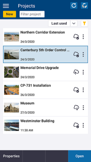
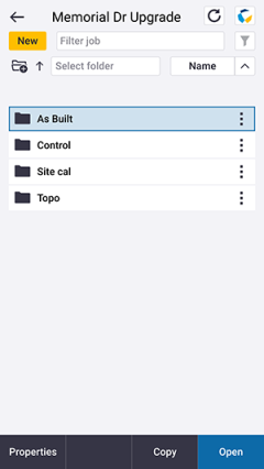 Job folders now supported
You can now create and store jobs in folders inside the project folder. This feature was supported in Trimble Access versions 2017.xx and earlier but was not continued in Trimble Access 2018.00 onward.
To create a folder on the controller, tap ![]() in the Jobs screen or in the New job screen. The folder path is shown at the top of the New job screen. Folders created in Trimble Sync Manager are downloaded with the project. For Trimble Access to be able to use the job, the combined length of the project folder name and folder names must not exceed 100 characters. The name of the job is not included in the 100-character limit.
in the Jobs screen or in the New job screen. The folder path is shown at the top of the New job screen. Folders created in Trimble Sync Manager are downloaded with the project. For Trimble Access to be able to use the job, the combined length of the project folder name and folder names must not exceed 100 characters. The name of the job is not included in the 100-character limit.
To move a job to a different folder, use the Copy job function in Trimble Access to copy the job and all linked files to the new folder and then delete the original job.
To avoid data synchronization issues, do not move jobs downloaded from Trimble Connect to a different folder.
For more information, see the topic Managing jobs in the Trimble Access Help.
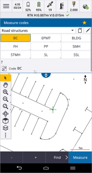
Edit Measure codes enhancements
In Trimble Access 2020.00, Measure codes buttons are now set up using the new Edit Measure codes screen. The full screen Edit Measure codes screen separates the tasks of configuring the available code buttons from the task of carrying out measurements. Configuration tasks include adding or changing codes within a group, re-ordering codes, managing code groups, selecting the number of code buttons per group and setting up templates for picking up coding routines. To view the Edit Measure codes screen, tap ![]() and select Measure / Measure codes, then in the Measure codes form, tap
and select Measure / Measure codes, then in the Measure codes form, tap ![]() .
.
When you set up a template for a coding routine, if the template does not use all of the available buttons, you can now assign the unused buttons to additional codes. For example, in a 3x3 button layout you could use 7 buttons in the template and assign the additional 2 buttons in the group to codes that you commonly measure but that are not part of the template. In a road cross section survey you might use additional buttons to measure a nearby manhole or stormwater grate while surveying the road cross section.
For more information, see the topic To assign codes to buttons in the Trimble Access Help.
Configuring the default name of the next point
Trimble Access now supports using different point names for different types of points. In previous versions of the software, the default name of the next point was always incremented from the last used point name in the previously opened job.
When creating a new job you can configure whether the point names in the new job auto increment from the last used job, or start based on the values set in your job template. You can edit the next point name fields when creating the new job or at any time in an existing job.
To specify the next point name for different point types, enter the required point name in the appropriate field(s). To use the same point name thread for different types of points, for example Topo points and Rapid points, set the Next point names for both Measure points and Rapid points to the same name.
Available point types include measured points, stake out points, keyed in points, construction points, laser points, scanned points, lines, arcs and polylines.
When creating a new job:
- If you have selected Last used job as the template, the default values for the next point name fields will continue from the last used job.
- If you have selected a template, select one of these options to determine the default name of the next point:
- Continue from last job: Populates the next point name fields with the next available point name from the last used job.
- Template: Populates the next point name fields with the names specified in the template.
For more information, see the topic Additional settings in the Trimble Access Help.
Storing IFC, DXF, Shapefile and LandXML design attributes with as‑staked points
When staking entities in an IFC, DXF, Shape, or LandXML file, you can now choose to save the design file attributes for the selected entity with the as-staked point. To do this, tap Options in the Stake out screen and set the As-staked code to Design file attributes.
Map enhancements
- Background image enhancements:
- Rotated georeferenced images are now supported.
- Grayscale background images are now supported.
For supported image file types and associated world files, see the topic Map background files in the Trimble Access Help.
- Exploding polylines named in TBC: For a polyline named in Trimble Business Center, each segment in the exploded polyline is now given a unique name, based on the polyline name and a segment number.
- Displaying labels for DXF, Shape, and LandXML files: You can now show or hide names, codes, and elevations for entities in DXF files, Shapefiles, and LandXML files separately from your label display settings for other background file types. To change these settings, tap
 in the map toolbar, select Settings and select the appropriate Display check box(es) in the Map data controls group. The software shows these extra labels only when the file is set to selectable in the Active map screen. If the file is only set to visible, the extra labels are not shown.
 - Displaying station values: You can now show or hide station names for LandXML roads. Previously this setting only applied to RXL alignments and RXL roads. To change this settings, tap in the map toolbar, select Settings and select the Display station values check box in the Map data controls group. Previously this setting was in the Display group.
- Hatching in DXF files: Trimble Access now supports hatching in DXF files. To show hatched polygons, tap in the map toolbar, select Settings and select the Hatch polygons check box. In addition, Trimble Access now supports RGB colors defined in the DXF file.
- Unnecessary map redraws: The map no longer redraws when you open the Active map screen and then exit without making any changes.
- Lighting effects: You can now control the lighting effects applied to surfaces displayed in the map. Lighting effects give more graphical depth to surfaces, but can introduce shading or shine effects in small areas on some surfaces. To disable lighting effects, tap in the map toolbar, select Settings and clear the Lighting effects check box.
- Selected entity highlighted during review: When reviewing an arc, polyline, or feature coded linework from the map, the selected entity is now highlighted in the map. Previously only points or lines were highlighted.
- Calculated resection positions: The calculated position of a resection is now displayed with a yellow dot before storing a resection.
- Copying points into the job: When using points selected from map files (such as a DXF file) or from linked files (such as a CSV file) to key in points or to compute an inverse or distance, the selected points are now copied to the job only when you tap Store.
- Check coordinates warning: Now when you add a point or map file that is a long way from data already in the job then the software warns the new data is a long distance from existing job data and prompts you to make sure the coordinates are correct. Tap Yes to continue, or tap Cancel to cancel the operation.
- Keying in points elevation: When keying in points from the map, if the map is in Plan view (2D), the Elevation field is set to null (?), and a value is optional. If the map is in one of the 3D views, the value in the Elevation field is calculated with reference to the ground plane, surface or IFC file. You can edit this value if required.
-
Keying in multiple points: When keying in multiple points from the map, you can now tap in the map to define the coordinates for each point. Previously this was only available for the first point. To do this, tap in the map when the current field in the Key in point form is the Northing or Easting field.
The Coordinate view option must be set to Grid or Grid (local). Grid (local) is available only when the Advanced geodetic option is enabled.
IFC file enhancements
Trimble Access 2020.00 includes the following enhancements for IFC files:
- You can now create points from selected vertices in the IFC file and save the points to the job. To do this, tap and hold in the map and select Create point.
- You can now select curved edges (polyedges), such as the rim of a cylinder, which can then be staked as a polyline.
- You can now review attribute information for vertices, edges, and surfaces in an IFC file in Trimble Access. To do this, select the entities in the map and then tap Review. If you selected more than one entity, select it from the list and tap Details.
- Trimble Access can now compute the center line of pipes and ducting in an IFC model. To do this, select the pipe and then tap and hold in the map and select Compute centerline.
-
Data from IFC models can now be shown in the Video screen when the controller is connected to a Trimble SX10 scanning total station. To enable the display of IFC files, in the Video screen tap
and then select Settings. In the IFC options group, enable the Overlay on video switch. - Selected entities are no longer lost when the selectability of other layers in the file are changed. Note that if the layer a selected entity is in is made non-selectable then the selection is lost.
- Improved selection and display of surfaces. In particular:
The selected surface is now displayed as a custom blue color instead of cyan to provide better contrast when the original material color is close to cyan.
The selected surface remains bright even when it occupies a dimly-lit portion of the model.
The selected surface is opaque even when on transparent parts of the model.
You can now deselect a surface by tapping it.
For more information, see the topic BIM and IFC models in the Trimble Access Help.
Reporting Measure to surface data
Measure to surface data is now exported and displayed in the Survey Report.
Improved surface display controls
The surface display controls for a road are now separate to those for a surface in a TTM, DXF or LandXML file. The display options for all surfaces are now selectable from a drop down list. Select the new Outline option to display a line around the outside edge of the surface with no shading.
For TTM, DXF or LandXML surfaces the options are:
- Color gradient
- Shaded
- Triangles
- Color gradient + triangles
- Outline
CAD toolbar enhancements
Trimble Access 2020.00 includes the following enhancements to the CAD toolbar that was introduced in version 2019.00:
- To display the CAD toolbar, tap on the map toolbar and then select CAD toolbar. You can no longer display or hide the CAD toolbar from the map Settings screen or from the map tap and hold menu.
- The software now filters the list of available feature codes to show only line feature codes defined in the feature library when you tap the Start join sequence button
 in Drawing mode, or when you tap a control code button when no feature code is entered in the Code field in the Measure points or Measure topo form. Previously all feature codes in the feature library were listed.
 - In Drawing mode the software now warns if there is no relevant control code defined in the feature library when you tap the CAD toolbar button, rather than when you attempt to draw the object. This is consistent with when warnings are given in Measure mode.
Reference azimuth job property
You can now specify a reference azimuth for a job. The reference azimuth can be used to align the job with, for example, a building footprint. The reference azimuth is specified as a property of the job in the Cogo settings screen.
You can specify or change the reference azimuth for the job in the Map settings screen. 3D map views (Top, Front, Back, Left, Right) are always oriented to the Reference azimuth. The Reference azimuth is also used by the map Limit box to align the Limit box sliders with map data. The plan view in the map is oriented to North by default, but you can choose to orient it to the Reference azimuth if required.
When staking a point in a GNSS survey, you can also edit the Reference azimuth when you select Relative to azimuth from the Stake field in the Options screen.
For more information, see the topic Cogo settings in the Trimble Access Help.
Selected items now shown in Stake out items list
When you select multiple items in the map and tap Stakeout, the software now adds all of the selected items to the Stake out items list, including points, lines, arcs, polylines and alignments. Select each item in turn from the Stake out items list and stake it out before returning to the Stake out items list. Previously the Stake out items list was named the Stake out point list and was shown only when multiple points were selected. To clear the Stake out items list, tap Rem all or double-tap in the map.
For more information, see the topic Stakeout in the Trimble Access Help.
LandXML alignments now permanently stored as Trimble RXL alignments
LandXML alignments must be stored as a Trimble RXL alignment for use in the Trimble General Survey software. The software prompts you to do this when you select a LandXML alignment to key in or stake out.
Previously the LandXML alignment was only temporarily stored as an RXL alignment, which meant it had to be defined each time you selected the alignment. The new workflow means that the alignment is only converted once.
Favorites and Functions enhancements
Favorites and Functions enable you to create shortcuts to software screens, map controls, or to enable/disable an instrument or receiver function. Trimble Access 2020.00 includes the following enhancements for Favorites and Functions:
-
Set a function key to open the Menu.
Trimble TSC7 controllers have a Menu key, which activates the main menu in Trimble Access. For controllers that do not have a dedicated Menu key, we have added the Menu function to the Assign special functions list. To assign a function key shortcut to the Menu, tap
 in the Favorites screen and tap + on the function key you want to use and select Menu.
 If you are using a tablet that has programmable buttons instead of dedicated function keys, such as the Trimble T10 tablet, then you must configure the button as a function key.
-
You can now add the map Settings screen to your Favorites list by tapping the
 icon at the top of the Settings screen. Previously you could only assign the map Settings screen to a function key using the Assign special functions list.
 -
Set function keys to enable/disable Autolock, FineLock and Long Range Finelock.
You can now set separate function keys to enable/disable Autolock, FineLock and Long Range Finelock, and add separate shortcuts for each target lock method to the Favorites screen. Previously the shortcut was always named Autolock. To assign a target lock method to a function key, enable the required method and then tap the
icon for the Autolock, FineLock or Long Range Finelock tile in the Instrument functions screen.
For more information, see the topic Favorite screens and functions in the Trimble Access Help.
Softkey enhancements
We have increased the number of softkeys available on TSC7 and tablet controllers from 5 to 6. This means that for most screens viewed in landscape mode there is no need for an additional row of softkeys. In most cases the position of softkeys remains the same as for previous versions of the software, except in the Jobs screen, where the Properties softkey has moved to the left. Note than when viewed in portrait mode, the softkeys consolidate so that no empty softkeys are shown.
Occasionally in landscape mode, and more commonly in portrait mode, the ![]() icon appears in the softkey row to indicate there are more softkeys available. To view more softkeys, tap
icon appears in the softkey row to indicate there are more softkeys available. To view more softkeys, tap ![]() or swipe right to left (or left to right) along the row of softkeys.
or swipe right to left (or left to right) along the row of softkeys.
Change of behavior when switching through all open screens
The map screen is no longer displayed when using Ctrl + Tab to move between open screens in the software, or when using Ctrl + Shift + Tab to move between open screens in reverse order. Note however that the Return to list in the Favorites screen still includes the map.
Instrument functions screen for Trimble C3 and C5 total stations
When connected to a Trimble C3 or C5 total station, you can now view the Instrument functions screen in Trimble Access by tapping the instrument icon in the status bar. The Instrument functions screen provides fast, easy access to a range of instrument functions, including enabling/disabling the laser pointer, and changing EDM measurement modes.
Auto detection of character encoding in CSV files
When opening linked CSV files or importing any of the predefined CSV file formats, Trimble Access now automatically detects if the file is using UTF-8 character encoding. If UTF-8 is not detected, Trimble Access assumes the data is using ASCII/Multibyte encoding.
When importing or exporting custom CSV files, encoding is set to UTF-8 by default. To change the encoding to a different format, edit the appropriate IXL and/or XSL file. For more information, refer to the Creating Custom Import Definitions PDF available from the Trimble Access Help.
Where possible, Trimble recommends standardizing on UTF-8 for your CSV files, because it can encode any character in Unicode. ASCII/Multibyte encoding is locale-specific and so may not encode all characters correctly.
Scan for Bluetooth devices from within Trimble Access
You can now scan for and pair with Bluetooth devices from within the Trimble Access software. Tap ![]() and select Settings / Connections / Bluetooth. Tap Search. The Trimble Access Bluetooth search screen shows a list of Discovered devices. Select the device to pair with and if prompted, enter the PIN. Once paired, the Trimble Access software prompts you to select the device type so that the software knows how to use the device.
and select Settings / Connections / Bluetooth. Tap Search. The Trimble Access Bluetooth search screen shows a list of Discovered devices. Select the device to pair with and if prompted, enter the PIN. Once paired, the Trimble Access software prompts you to select the device type so that the software knows how to use the device.
In previous versions, Bluetooth pairing could only be done from the operating system. Once paired, you had to return to the Trimble Access Bluetooth screen and locate the paired device in the correct device type drop-down list.
Global reference datum enhancements
Trimble Access 2020.00 shows improved global reference datum information, whereas previous versions of the software used the term WGS84 to refer to coordinates in a global reference frame.
The reasons for these software changes are to:
- Make it clearer which coordinate system positions are provided in.
- The use of the term Global is consistent with Trimble Business Center software.
- Recognize the evolution of reference frames for high precision measurements driven largely by advances in GNSS techniques.
The exact changes to the software are outlined below.
Trimble Access now displays extended datum information
When the customer selects their coordinate system and zone in the Select coordinate system screen of the Job properties, the software will now show these fields:
- Local datum: The local datum for the selected coordinate system and zone. In previous versions of the software this field was named Datum.
- Global reference datum: The datum of RTK measurements, such as the reference frame of base stations including VRS.
- Global reference epoch: The epoch of realization of the global reference datum.
If you perform an RTK survey in the job, you must make sure the selected real-time correction source is providing GNSS positions in the same datum as that specified in the Global reference datum field. This has always been true when selecting a real-time correction source so this change does not mean a change to your workflow.
WGS84 coordinate view option renamed to Global
When selecting the Coordinate view, the WGS84 and ECEF (WGS84) options have been renamed to Global and ECEF (Global) to better reflect what the software is showing. Selecting these options shows positions in the Global reference datum at the Global reference epoch.
This change is simply renaming an existing option in the software. There is no change in software behavior.
RTX data now transformed to the Global reference datum
RTX positions are always computed in the receiver as ITRF 2014 at the epoch of measurement.
In previous versions of Trimble Access, the tectonic plate model in the receiver was used to propagate RTX coordinates to a common epoch of ITRF 2008 at epoch 2005.0, which is how they were stored in the job. A site calibration and/or an RTX‑RTK offset were required to transform these coordinates from ITRF 2008 at epoch 2005.0 into the local coordinate system of the job.
In Trimble Access 2020.00, RTX positions are stored in the job as ITRF 2014 at the epoch of measurement. The tectonic plate model in Trimble Access is used to propagate these coordinates to the global reference epoch for the job, and a datum transformation is applied to transform them into the global reference datum. This may remove the need for a site calibration and/or an RTX‑RTK offset.
To use Trimble Access 2020.00 jobs containing RTX data in Trimble Business Center, you must use TBC version 5.30 or later.
Older Trimble Access jobs with RTX data can be upgraded and used with Trimble Access 2020.00. On upgrade, the Global reference datum of the job is set to ITRF2008 at epoch 2005.0. If the job contains an RTX-RTK offset, that offset remains valid following the upgrade.
GNSS constellation tracking enhancements
For GNSS RTK and RTX surveys, you can now change the signal tracking of entire constellations from the Satellites screen. Tap the satellite icon in the status bar to open the Satellites screen and then tap Options and select or clear the check boxes in the GNSS Signal Tracking group box. The available constellation control check boxes depend on the settings in the current survey style.
Galileo signal tracking enabled by default
For GNSS surveys, Galileo satellite signal tracking is now enabled by default. To disable tracking of Galileo satellites, clear the Galileo check box in the GNSS Signal Tracking group box in the Rover options or Base options page of the survey style.
RTK initialization status bar messages
When connected to a Trimble RTK receiver that has HD-GNSS or ProPoint™ GNSS technology, Trimble Access no longer shows RTK initialized and RTK not initialized messages in the status bar or in the Review job screen. This allows for the current precision values to remain clearly visible on the status bar. RTK initialization records remain embedded in the job file and can be viewed in JobXML export if needed.
Inclined plane adjustments
When performing a site calibration or a Helmert transformation, Trimble Access now fits an inclined plane only if you have three or more points. If you have one or two points then the software calculates just the constant adjustment. Previous versions of Trimble Access would fit an inclined plane to two or more points, and calculate just the constant adjustment if you had a single point.
Show passwords
When typing in a password, you can now tap ![]() to see the characters you are entering.
to see the characters you are entering.
Controller simulator
If you are running the Trimble Access software on a desktop computer or laptop, you can use the Simulate controller function to simulate running the software on a supported controller. This feature allows you to demonstrate the software or capture screenshots of the software with your preferred controller layout for inclusion in training materials. It can be used in conjunction with the GNSS emulator function to simulate a connection to a GNSS receiver.
For more information, see the topic To simulate a controller in the Trimble Access Help.
Coordinate system database updates
- Added the ONGD17 datum and UTM zones for Oman.
- Added the RD2018 datum grid and geoid model for Netherlands.
- Added the referenced geoid model Austrian Geoid 2009 for Austria.
- Added the S-JTSK Krovak zone for Czech Republic.
- Added UTM coordinate system zones for Tanzania.
- Renamed Brunei systems into groups.
- Added the DHDN shift grid datum and a new GK (NTV2) zone group and coordinate system zones referencing this datum for Germany.
- Added the GDM2000 datum definition and a new GDM2000 zone group and coordinate system zones referencing this datum for Malaysia.
- Added the ISN93, ISN2004 and ISN2016 datum definitions and geoid models for Iceland. Added the ISN2016 coordinate system zone to the ISN zone group and updated datum references on the existing zones in this group.
- Added the MAGNA-SIRGAS datum definition for Colombia and then used this as the reference datum for the Colombia MAGNA-SIRGAS coordinate system zones.
- Added geoid model references for the HS2 project zones (HS2GM02 and HS2GM15) for the United Kingdom.
New hardware support
Trimble TDC600 handheld
Trimble Access version 2020.00 supports the Trimble TDC600 handheld, an ultra-rugged smartphone running the Android 8.0 operating system. The TDC600 handheld features a high resolution 6‑inch display, 4 GB RAM and 64 GB internal storage.
Spectra Geospatial SP85 GNSS receiver
Trimble Access version 2020.00 supports the Spectra Geospatial SP85 GNSS receiver.
Bosch GLM 50c laser rangefinder support
Trimble Access version 2020.00 supports the Bosch GLM 50c laser rangefinder.
For more information, see the topic Laser rangefinders in the Trimble Access Help.
Resolved issues
- LevelMe Now Available with Trimble Access 2020.00: We have fixed an issue in Trimble Access that means LevelMe is now available for the latest release of Trimble Access. Previously LevelMe was only available for version 2017.xx and 2018.xx.
-
Linked file links now stored relative to the job: The path to linked files is now stored as a relative path to the job file. In previous versions the full path to the linked file was stored, which meant that the file could not always be found if the job was copied from one project to another or to a different controller.
- Uploading changes in local jobs: If you change the status of a local job in a cloud project to Work in progress or Fieldwork complete the changes in the job are now uploaded to the cloud. In earlier versions changes were uploaded only if you had previously manually uploaded the job to the cloud (by tapping and selecting Upload).
- Sign in to Trimble Connect: We have fixed an issue where Trimble Access did not always remember your Trimble ID sign in details, despite the Stay signed in check box being selected.
- Expired Trimble Connect sessions: Files updated in the cloud were not always appearing for download if the current Trimble Connect session had expired. Now if the current session expires you need to sign in again.
- Downloading project reference files from Trimble Connect: Project reference files, for example a geoid file or feature code library, that are updated in Trimble Sync Manager are now shown as available for download. When downloading a project reference file that is used by another project, you can now resolve any file conflict in the Download screen by tapping on the file and selecting Overwrite local file to update the file on the controller, or Keep local file to retain your local copy of the file.
- Downloading duplicate files from Trimble Connect: If you are downloading files with a job that are exactly the same as the files downloaded with another job in the same project, the software no longer shows a file conflict message. If attached files are different to previously downloaded files, you can resolve the conflict in the Download screen by tapping on the file and selecting Overwrite local file to update the file on the controller, or Keep local file to retain your local copy of the file.
- Map: We have fixed several issues with the map, where:
- The Cloud color option was not available in the Color mode field in the Point cloud group box in the Map display settings screen.
- TTM files that contained triangles with duplicate vertices sometimes showed a constant incorrect elevation value in parts of the file.
- Models in IFC files were sometimes shown with jagged edges.
- DXF entities defined in paper space but not model space were not shown if the Viewport was set to Not active.
- Named polylines in a DXF file now have unique identifiers when added to the map.
- Valid LandXML files: We have fixed an issue where if the LandXML file had unexpected records at the start of the file, the software would show the error message There are no points, lines, alignments or TIN surfaces to display. This issue was inadvertently created in Trimble Access 2018.00.
- CAD toolbar: We have fixed several issues with the CAD toolbar, where:
- The CAD toolbar now returns to the default state (with no buttons selected) when you open a different job.
- The map sometimes no longer showed a zoom box when using the Zoom in
 or Zoom out
 tool to zoom to a selected area if the CAD toolbar had been previously used in Drawing mode.
- Backspace press in Code field: We have fixed these issues where, when Auto fill from the feature library was enabled, pressing the Backspace key once in the Code field correctly cleared the last value in the field but pressing the Backspace key a second time moved the cursor to the start of the code field, instead of clearing the next code.
-
Measure codes: We have fixed an issue where if you appended an additional code to a point then measured another point using a different Measure codes button, the appended code from the previous point was incorrectly appended to the code of the subsequent point.
- Sorting lists by point names: When you sort points by point name, such as in the Stakeout or Review screen, points are now listed in the correct numerical order.
- Missing round numbers: We have fixed an issue where, when reviewing the residuals after measuring rounds or performing a resection, the round numbers were not shown.
- Adding abandoned targets: We have fixed an issue when adding a target, where if you tapped Esc and then confirmed you wanted to discard your changes, the target was still added.
- Reconnecting to instrument: We have fixed an issue where Trimble Access did not reconnect to an instrument if you had previously canceled the connection attempt when the connection was initiated by selecting the survey style.
- Copied station setup: We have fixed an issue where if you copied the previous station setup into a new job all of the observations were copied in correctly but the mean turn angles were not shown and all observations were shown as taken on face 2, even when taken on face 1.
- Check backsight point: We have fixed an issue where taking a check measurement to a backsight point updated the feature code for the backsight point with the feature code for the last measured point.
- Site calibration changing the map filter: We have fixed an issue where after performing a site calibration, the map display reverted to an earlier map filter setting rather than the most recent filter applied.
- SX10 instrument record angular accuracy: We have fixed an issue where the Horizontal Angle Precision and Vertical Angle Precision values for the Trimble SX10 scanning total station instrument record in the job were incorrect. The issue only affected the instrument record. The precision values stored with each observation have always been correct.
- S Series angular accuracy rounding: When storing angle accuracy values for Trimble S Series instruments, values are now stored to the nearest 0.5 seconds. Previously these values were rounded to the closest whole second.
- Long Range FineLock icon incorrectly shown: We have fixed an issue where if you were connected to a Trimble S Series instrument with Long Range FineLock enabled and then connected to a Trimble SX10 scanning total station, the Long Range Finelock icon was still shown in the status bar.
- AT360 firmware version incorrectly reported: We have fixed an occasional issue when connecting to an AT360 active target where Trimble Access fails to connect, incorrectly reports the AT360 target firmware version and requires the Bluetooth connection to be reconfigured.
- T04 GNSS data files now shown as locked during logging: Trimble R10-2 receiver data (.t04) files are now shown as locked when GNSS data logging is in progress. The file cannot be imported or deleted when a PPK survey is running.
- Spectra Geospatial base receivers: When starting a Spectra Geospatial base receiver, you can now use GPS L5 with ATOM Standard, Compact, and Super Compact broadcast formats.
- Fast fix no longer uses feature codes: When measuring points using Fast fix when the Measure codes form is open, the Fast fix points no longer have the previously used line feature code applied.
- GPS search in RTX integrated survey: When using GPS search during an integrated survey that uses RTX, the instrument now turns to the GPS position before starting to search, instead of starting the search where the instrument is currently pointing.
- GNSS tilt sensor calibration age limit: When you edit the value in the Calibration age limit field of the GNSS tilt sensor options screen, the entered value is now retained, instead of resetting almost immediately to 30d0h.
- Keypad navigation of the software: We have fixed several issues when using arrow keys to move through fields in some forms and using the spacebar key to select items.
- Media file changes in Review job screen: When adding or editing media files for a point, the changes are now shown correctly in the Review job screen. Previously, changes were shown only when the Review job screen was reopened.
- Job properties notes export: When exporting a job to a JobXML (JXL) file, the contents of the Job properties Notes field are now exported to the JXL file and are available for including in reports via stylesheets.
- Application errors: We have fixed several issues that caused application errors when using or closing the software. In particular:
- Trimble Access can now open large jobs saved from version 2017.xx and later. Previous versions of the software would fail to convert very large jobs.
- You will no longer see a Missing geoid file message when you open a Trimble Access job that was exported from Trimble Business Center.
- You will no longer see an application error when deleting the two remaining points in a job using Point manager when the Display deleted points check box is not selected in the Point manager options screen.
- You will no longer see an application error when using Point manager and you tap a column heading to sort points when some points are nested below others, for example when the job contains Measure rounds data.
- You will no longer see an application error when you edit the code of a point you added to the selected items in the map after you opened the Review screen.
You will no longer see an application error when you include a vertical line in an area calculation.
- We have fixed an application error that occurred when Yes was selected in response to the warning message "The broadcast coordinate system has changed. Continue?". This message appears at survey start when the epoch of the RTCM Transformation being received from the network RTK server has changed since starting the last survey using that transformation.
- You will no longer see an occasional application error when changing the job properties while performing stakeout during a conventional survey.
- You will no longer see an occasional application error when attempting to connect to an S series or VX total station.
- You will no longer see an occasional application error when attempting to reconnect to a Trimble SX10 scanning total station after the previous connection was interrupted while a scan was in progress.
- You will no longer see an occasional application error when waking up a controller connected to a power source and running Trimble Access.
