2022.10
Version 2022.10 of the Trimble Access software is available from October 2022.
These Release Notes describe the new features and changes available in this release of the
Have you subscribed to the Trimble Access YouTube channel?
The Trimble Access team has been busy posting over 40 new videos highlighting useful software features to the new Trimble Access channel on YouTube. Watch our recent videos on Scheduled Data Sync and Using Web Feature Services or, to dig deep on a specific software area, take a look at one of our playlists. So far we have playlists on using the R12i with Trimble Access, Scanning and IFC files, and more. There's also a playlist highlighting the latest changes in this version of Trimble Access.
We post new videos regularly, so make sure to click Subscribe on the Trimble Access YouTube channel page to get notified as soon as they land.
New features
Underground utility locator support
If you use an underground utility locator to locate buried assets, you can now connect Trimble Access to the utility locator and measure the location of underground assets such as cables and pipes. Trimble Access stores a pair of points: a ground point measurement and a vector from the ground point measurement to the utility using the depth received from the connected utility locator.
An FXL feature code library file and an RD8100.uld file for the Radio Detection RD8100 cable and pipe locator is provided in the C:\ProgramData\
Use the Utility Location Definition (ULD) file with the FXL file to set up your job for measuring points using the utility locator.
Once you have created a job that uses the FXL file and defined the Utility locator settings in the survey style, you can connect to the utility locator and measure points using the codes configured with attributes to record the depth information from the utility locator.
You may be able to use the supplied RD8100.uld file as a template and modify it to use the Trimble Access software with a different model of utility locator, provided that the communications protocols are similar to the protocols supported by the RD8100.
For more information, see the topic Utility locators in the Trimble Access Help.
IFC and TrimBIM files are now supported on Android
You can now view and use IFC files and TrimBIM (.trb) files on the TSC5 controller, TDC600 handheld and the TDC650 handheld GNSS receiver running Trimble Access. IFC files and TrimBIM files are BIM models that provide a 3D model of a building or other built asset such as a bridge, road, or pipeline.
IFC and TrimBIM files are not supported on the TCU5 controller.
If your project includes IFC files or TrimBIM files you can now use Trimble Access to:
-
View some or all of the layers of the BIM model in the map.
-
View data from BIM models overlaid on the video feed if the controller is connected to a Trimble SX10 or SX12 scanning total station.
-
Select items in the BIM model from the map and then use them in other software functions, for example to calculate and store the closest distance from the measured point to the selected BIM surface.
-
Use the Compute center point Cogo function to find the center point of a bolt or cylinder so you can then stake it out.
-
Use the Compute centerline Cogo function to compute the centerline of any tube-like item in a BIM model, such as a pipe or cylinder.
-
Compare the scan point cloud of an as-built surface with whole objects or individual faces in a BIM model using the Surface inspection Cogo function.
-
Select vertices and stake them as points or select edges, curved edges, or grid lines and stake them as lines directly from the BIM model.
For more information on using IFC and TrimBIM files in Trimble Access, see the topic BIM models in the Trimble Access Help.
48 hour license when unable to sign in
We know it happens – you picked up a different controller this morning and your subscription is locked to another controller. Now you have arrived at the job site and need to sign in but there is no Internet connectivity. The last thing you need is to drive down the road to the nearest hotspot and sign in. Instead, you can simply tap Help, I can't sign in! at the bottom right of the Sign in screen to activate a 48 hour license.
The 48 hour license enables you to keep working when:
-
your subscription license is locked to another controller, or when you haven't locked your subscription to your current controller and you are now on-site without an Internet connection.
-
your perpetual license has not yet been assigned to your controller and you need to get started on-site.
All installed Trimble Access apps will run with full functionality for 48 hours. To continue working beyond that period, you must sign in with your usual Trimble Access subscription or run Trimble Installation Manager and install a perpetual license within the 48 hour license period. You can check the number of remaining hours in the About screen.
Export to LandXML
You can now export to a LandXML file. Export options include points, feature coded linework and database linework.
Attributes associated with the points and linework are also exported to the LandXML file.
Attributes recorded as featureRef attributes found in a CgPoint element can now be reviewed.
Enhancements
Media file naming
You can now configure a standard format for naming media files, so that you can more easily identify the media file that corresponds to a job or point. In the Media files screen, select the elements to include in the image file name. For images linked to points you can include the point name and code. For any image you can include the job name, date and time. You can also add the same custom text to an image file name. If required, the software automatically appends a number to the end of the custom text string to ensure a unique file name.
If you have selected the Show with new media file option in the Media files screen, you will be able to edit the media file name in the media file screen after capturing the image.
For more information, see the topic Media files in the Trimble Access Help.
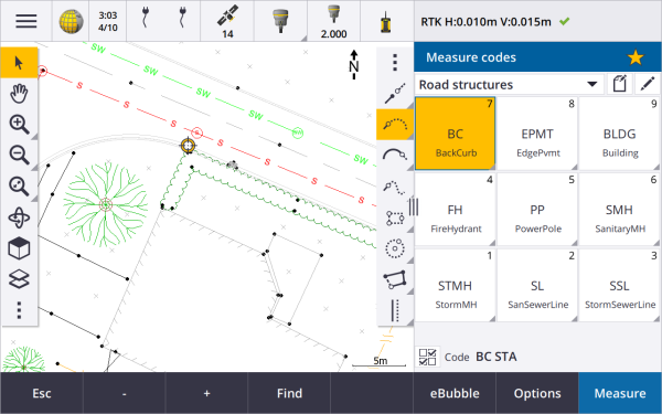
Feature library enhancements
Feature coded linework and symbols now shown in the map
Feature library files created using the Feature Definition Manager in Trimble Business Center can include rich linework and symbol definitions for different feature codes. Trimble Access now supports symbols for point, line and block codes, including 1‑point, 2‑point, and 3‑point blocks. This enables you to use different symbols to represent different features, and see those features represented in the map. For example, you can now code lines to visually represent real world features such as hedges, or add text characters into the drawn line, such as ST.
Feature symbols are created in Trimble Access and Trimble Business Center by processing the code on points with the symbols defined in the FXL file. You can export feature coded symbols as a DXF file from Trimble Business Center. Feature coded symbols cannot currently be exported from Trimble Access, and features will be represented as simple points and lines in an exported file.
To view symbols in the map, tap
and select Settings, and then from the Point symbols field select Feature symbols.
FXL file colors defined by layer
When using an FXL file created using the Feature Definition Manager software where colors are defined By layer, Trimble Access now uses the color defined in the FXL file. If a layer color is not found then Trimble Access uses black. Previously Trimble Access always used black where the FXL file defined colors By layer.
Automatically install example feature library file during software installation
You can now install the GlobalFeatures.fxl example feature library file when you install the Trimble Access software.
Install the GlobalFeatures.fxl using Trimble Installation Manager. If you keep the GlobalFeatures.fxl check box selected in Trimble Installation Manager, the file will be installed each time you install or update the software, including any updates to the GlobalFeatures.fxl. The GlobalFeatures.fxl file is installed to the System Files folder. If the GlobalFeatures.fxl file already exists in that folder, the new file is named GlobalFeatures(1).fxl.
The GlobalFeatures.fxl feature library file has feature codes set up for points, attributes, lines and symbols, and control codes for drawing features using the CAD toolbar. You can use the file to see how the feature library files makes it easy to enter attributes, draw features using the CAD toolbar, or measure and code features in one step using Measure codes.
To set up your own feature library file, you can take a copy of the GlobalFeatures.fxl file and edit it in Trimble Access or using the Feature Definition Manager in Trimble Business Center.
For more information on using feature library files, see the topic Feature library in the Trimble Access Help.
Design file attributes automatically copied to job
When you use an entity from a design file (including a BIM model, DXF file, Shapefile, or LandXML file) in a Cogo calculation, during stakeout, or to create a point in the job, Trimble Access now automatically copies the attributes of the object from the design file and stores them with the point or polyline in the Trimble Access job. Previously, you needed to configure the software to save the design file attributes for the selected item with the as-staked point.
To review design file attribute information for entities in a design file, select the entities in the map and then tap Review. If you selected more than one entity, select it from the list and tap Details.
Export enhancements
Trimble Access version 2022.10 includes the following enhancements for exporting data:
Configurable CSV delimiter
When exporting a CSV file using the Comma Delimited (*.CSV, *.TXT), CSV Global Lat-long points, or CSV with attributes file formats you can now select the Field delimiter that separates the data in your file into distinct fields. The delimiter options include comma, semicolon, colon, space, and tab.
Exporting points with combined ranges
When selecting points for export using Points with same code, or Points by name range you can now select up to 5 codes or 5 point name ranges instead of just one.
DXF export enhancements
Point names, codes, elevations and extra attributes associated with the inserted blocks as attribute text are now enabled for display by default in DXF files.
The point name, code, elevation and extra attributes included as attribute text are now added to their own individual layers.
You can now select the number of decimal places exported on elevation labels.
Georeferencing map files
When georeferencing a map file it is now relocated to the center of the current view. Previously an approximate georeference was performed by relocating the center of the map file close to the existing job data. This could make it difficult to find the map file to fine-tune the georeferencing if the job data included data, for example a base point, that was a long way from the other data in the job.
Control code behavior now aligns with Trimble Business Center control codes
Trimble Access uses the same control codes as Trimble Business Center to create line, arc, or polygon features from points, but in some cases the control code behavior was subtly different between these two applications. We have made changes to the behavior of the tangential arc, skip join, and close polygon control codes so that Trimble Access now processes these codes in the same way as Trimble Business Center.
Depending on how you have been using these codes, you may now need to use these control codes slightly differently.
For more information on how to use control codes to create features, see the topic To create features using control codes in Measure codes in the Trimble Access Help.
Sync scheduler
Local jobs in cloud projects can now be automatically uploaded according to the settings defined in the Sync scheduler.
If the current project is a local project and does not yet reside in the cloud, then when you set the Automatically upload the current project switch to Yes, Trimble Access now shows a message asking if you want to upload the project now. In the message box:
-
Select the Connect server to use and tap Yes to upload the current project to the cloud. The configured File upload settings will apply to the project.
-
Tap No if you do not want to upload the current project to the cloud. The configured File upload settings will not apply to the current project unless it resides in the cloud. To upload the project to the cloud later, select the project in the Projects screen and then tap
and select Upload.
Station interval improvements for alignments
During alignment stakeout, when selecting a station from the list, you can now use the new Select station screen to:
-
Define a station interval for lines and a separate station interval for arcs and transitions. A separate station interval value for arcs and transitions enables you to tighten the interval for curves and more accurately represent the design on the ground.
-
Specify the available station types from the station list. Previously they were only available at the Options screen when starting the stakeout process.
-
Select the Method used to increment the station interval:
-
The 0 based method is the default method and gives station values that are multiples of the station interval.
-
The Relative method gives station values relative to the start station.
-
For more information, see the topic Stations available for stakeout in the Trimble Access Help.
Sta+ and Sta- function keys
When assigning favorite functions to function keys on the controller, we have renamed the Stakeout station increment function to Station+ and renamed the Stakeout station decrement function to Station-, to more closely match the names of the Sta+ and Sta- functions as they appear on softkeys. Assign these functions to a controller function key so that you can select the next station with a single keypress when staking a line, arc, alignment or polyline.
For more information, see the topic Favorite screens and functions in the Trimble Access Help.
Stakeout deltas
We have improved the display of stakeout deltas so that deltas that are irrelevant to the selected item and stakeout method are not available.
In addition, you can now select Design station, Design string, Design horizontal offset and Design vertical offset values from the list of deltas. These are particularly useful when you have elected to not show the stakeout graphics.
For more information, see the topic Stakeout navigation deltas in the Trimble Access Help.
IFC 4.3 files
Trimble Access version 2022.10 reads IFC 4.3 files. IFC 4.3 supports linear infrastructure assets including roads, rail and bridges. IFC 4.3 is a new schema, and there are very few products that can currently create IFC 4.3 files. As a Strategic Member of buildingSMART International, Trimble is committed to working with our industry partners on supporting this open, vendor-neutral international standard. If you obtain an IFC 4.3 file that does not work as expected in Trimble Access, please pass the file to us via your Trimble Distributor.
Separate configuration settings for Resection and Measure rounds
Trimble Access now saves your settings separately for Resection and Measure rounds measurements, so you can configure them independently. Station setup plus settings were always saved independently. To use the same settings across all measurement types, tap Options the appropriate measurement screen and configure the settings per your requirements.
Add snapshot and description fields to Measure rounds
When measuring rounds of observations, you can now automatically add a snapshot to the first observation for each point in the first round.
If the job is using additional Description fields, these fields are now available when measuring rounds.
Target lock mode now stored in job
The target locking mode used to measure the point is now stored with the observation in the job, and is included when exporting to JXL.
Improved icon when target lock is lost
We have added a pulsing red halo to the rotating target icon in the status bar that indicates when the instrument has Autolock enabled but is not currently locked onto a target.

Perpendicular target height method for Object oriented setup
Trimble Access version 2022.10 provides a new target height method, Perpendicular, for use when performing an Object Oriented Setup with the target mounted on a surface. In the Targets screen tap ![]() and select Perpendicular. Enter the height of the target, measured from the base of the target to the center of the target. In the Perpendicular to surface field, enter the name of the surface, or select the surface in the map.
and select Perpendicular. Enter the height of the target, measured from the base of the target to the center of the target. In the Perpendicular to surface field, enter the name of the surface, or select the surface in the map.
The object oriented station setup is available only when the Object Oriented Setup Trimble Access software option is licensed to the controller. To purchase a license for the Object Oriented Setup option, contact your Trimble Distributor.
EDB10 Bluetooth connection
When connecting to the EDB10 Data Bridge using Bluetooth, the Trimble Access software now automatically sets the Controller port in the Radio settings screen to BT Radio. Previously when setting up the Bluetooth connection to the EDB10 you had to switch to the Radio settings tab and tap the Options softkey to configure the Controller port yourself before the EDB10 would connect.
Receiver Wi-Fi configuration
We have improved the Receiver Wi-Fi configuration screen so that it now provides separate tabs for Access point mode and Client mode. Each mode can be enabled separately, and allows some receivers (such as the Trimble R10 and R12 GNSS receiver) to have both modes enabled at the same time. For receivers that support only one mode at a time, enabling one mode in the Receiver Wi-Fi configuration screen automatically disables the other mode. In addition, the Trimble Access software now only prompts you to restart the receiver if the connected receiver must be restarted for new settings to be applied. For some receivers, modified settings are applied without the receiver having to be restarted.
Antenna list now provided by the Antenna.ini file
Trimble Access version 2022.10 reads the list of available antennas from an Antenna.ini file, rather than an Antenna.dat file. The advantages of using a .ini file are:
-
The Antenna.ini file is now installed using Trimble Installation Manager, and can be updated independently from updates to the Trimble Access software, if required.
-
The file can now be edited in a text editor, if required. For example, you can edit the Antenna.ini file to add a new antenna or to shorten the list of antennas that you can choose from when creating a survey style.
When you upgrade to Trimble Access version 2022.10 the existing Antenna.dat file will be retained in the C:\ProgramData\
Satellite subset now stored in note
If a satellite subset is active, a note is now added to the point record as the point is stored, indicating which satellite subset (SV set A or SV set B) applies. The notes are included when exporting the job. No note is added if all the satellites have been used.
Auxiliary GNSS positions no longer included in map extents
Auxiliary GNSS positions from the controller's internal GNSS receiver are no longer included in map extents, unless there is a current station setup that is using GPS search. For example, if you leave the job site and return to the office and open the job, your current position is no longer included in the map. This change is especially useful when zooming to job extents or when adding data where the software would prompt you to georeference files because the current position was a long way from the map data.
QC graph no longer includes base positions
Trimble Access now excludes GNSS base points from the selection set used for the QC graph.
Unique survey style names
When you create a survey style using the New or Copy softkeys in the Survey Styles screen and enter the name of the new survey style in the Survey details screen, the software now checks that a survey style of the same name does not already exist.
Workflow improvement for drop-down lists
When you select an item in a drop-down list, the software focus now automatically moves to the next available field, and that field is highlighted.
Performance improvements
-
Trimble Access now uses less operating system memory when loading background files including JPG, PNG, TIF files and data from a Web Map Service (WMS). You should now see faster map updates and more reliable performance, particularly on Android controllers.
-
You should now see fewer map update delays when closing the Layer manager when Auto update is enabled.
-
When using a Trimble SX10 or SX12 scanning total station, we now stop streaming video when switching from the Video screen back to the Map. This can result in better battery life and improved performance when working at extreme radio range. This change was made for Trimble S-Series instruments with video in Trimble Access version 2022.01.
Coordinate System Database updates
The
-
Added UCS-2000 coordinate system for Ukraine.
-
Added new ETRS89-D96-17 reference frame for Slovenia.
-
Added new TMCI-5.5 coordinate system for Ivory Coast.
-
Added "System Cityring" for the Metro in Copenhagen.
-
Added EGM2008 geoids for Guyana, Eastern Caribbean & Middle East.
-
Added new geoid Pl-geoid-2021 for Poland.
-
Fixed geoid model for Cyprus.
-
Updated EPSG ID for geoid models in Switzerland.
-
Cleaned up datums & zones used in the US.
-
Updated datum JGD2011 for Japan.
-
Updated displacement model POSGA07 for Argentina.
-
Updated displacement model NKG-RF17 for Northern Europe.
-
Added ITRF2020 and missing realizations for WGS84, IGS & RTX.
-
Fixed incorrect reference epoch for Prince Edward Island, Canada.
Resolved issues
-
Signing in: When signed in, the software no longer prompts you to sign in each hour. We have also fixed other issues that sometimes caused other project-related messages to appear when signing in.
-
Exit Sign in screen: When presented with the Sign in screen, you can now tap X in the top right corner if you want to exit the screen rather than sign in.
-
Downloading projects: We have fixed an issue where if team members were part of a group then they were unable to download projects assigned to them.
-
.0 appended to project name: We have fixed an occasional issue where deleting a cloud project from the controller and then downloading the cloud project onto the controller again sometimes resulted in two projects with the same name appearing on the controller, with .0 appended to one project name.
-
CadastralTolerances.xml copied with job: When copying a job using the Copy job screen in Trimble Access, if the System files folder contains a CadastralTolerances.xml file then the file is now copied with the job.
-
DXF export: We have fixed an issue when exporting to DXF, where the FXL file from the current job was used for the export when the job being exported was not the current job. This could result in an incorrectly feature coded layer, line color, or line style.
-
Incorrect Global reference datum used when selecting a coordinate system with a datum grid: We have fixed an issue where the correct Global reference datum was displayed in the Select coordinate system screen, but the software actually used WGS 84 as the Global reference datum. This would result in incorrect results when transforming RTX positions.
-
Reloading CSV files after changing coordinate order: If you change the Coordinate order for the job in the Units screen, then any CSV files attached to the job are now automatically reloaded to read the columns correctly in the CSV files.
-
Georeference map files: We have fixed an issue where if you added map files to the job that contain data at a location far away from existing job data, the software did not prompt to georeference the map files if the existing job data was in a linked CSV file. The software did show the prompt when the data was in a linked job file.
-
WFS server data: We have fixed the following issues when connecting to and using data from a WFS server:
-
We have improved server type detection. This resolved an issue where sometimes Trimble Access was not able to connect to the configured WFS server.
-
Trimble Access now includes the version parameter when requesting data from a WFS server. This resolves an issue where sometimes Trimble Access could connect to the WFS server but no data was shown in the map.
-
WFS parameter settings are now consistently saved before you tap Next. Previously some settings were not saved which could result in incorrect parameters being used.
-
When connecting to a WFS that requires authentication which you have set up using Trimble SiteVision™ Manager, Trimble Access no longer prompts you to enter your user name and password twice.
-
Errors are no longer shown when requesting data from servers where the URL includes spaces or + characters.
-
-
BIM model display: We have fixed an issue where setting the display of BIM models to Wireframe or transparent also changed the display of other map files to transparent.
-
Elevation value for keyed in points: We have fixed an issue where sometimes the Vertical exaggeration value affected the elevation determined from a surface when keying in a point.
-
Elevation value for points from a DTM: When you tap and hold on a DTM, the software now always interpolates the elevation from the DTM, whether the map is in plan view or in orbited view.
-
Compute inverse: We have fixed an issue where if the points used to compute an inverse included points from a linked job and one of those points replaced a deleted point of the same name in the linked job, then the coordinates of the deleted point were used in the calculation.
-
Attributes for offset lines and polylines: We have fixed an issue where the Attributes softkey was not shown and the software did not prompt for attributes to be filled out when you offset a line or polyline and then assigned a feature code that has attributes.
-
Attributes not remembered: We have fixed an issue where, when measuring a point with two code values, the last used attribute values for both codes were not remembered if the order of the two codes was reversed for the previously measured point.
-
Polyline drawn incorrectly: We have fixed an issue when measuring a polyline, where after adding an arc to the polyline an additional line was drawn through the arc to the previous point.
-
CAD toolbar message: We have fixed an issue when using the CAD toolbar where if the software showed an error warning the selected point could not support the intended action, sometimes the wrong point name was referenced in the message.
-
Stakeout deltas for XYZ (CAD): When staking out using the XYZ (CAD) coordinate order, the Delta X and Delta Y coordinates are now shown in the As staked deltas and Job review screens.
-
Polyline stakeout: When staking out a polyline containing non-tangential segments, Trimble Access would previously determine that the closest point on the polyline was always to a line or arc segment, even if there was a vertex closer than that segment. Now, it will include any available vertices when determining the closest point.
-
Alignment stakeout: When you stake out an alignment from the menu, the current map selection is cleared to make sure there is no alignment already selected in the map. This resolves an issue where it was possible for the software to show the name of the alignment you selected from the menu, but you were in fact staking a different alignment that was already selected in the map. .
-
Check backsight: When you open the Check backsight screen, the Method field now reverts to the last method used to measure the backsight position whether you opened the screen using the Chk BS softkey or by pressing Ctrl + K. When you exit the screen the software reverts to the last method used to measure a topo point.
-
Target settings not retained after checking backsight: We have fixed an issue where the target semi-active tracking setting could be switched to passive tracking following a Check backsight observation.
-
Incomplete panorama screen: We have fixed an issue where after replacing the battery in the connected instrument when the Panorama screen was open, the software resumed but sometimes there were some fields missing from the Panorama screen.
-
SX instrument adjustment: We have improved the instrument adjustment error messages when adjusting a Trimble SX10 or SX12 scanning total station, so that whatever the angle units you are using, the information provided is similar to that provided for DDD.MMSS.
-
Surface inspection: We have improved the performance of the Scan to Surface inspection, which ran very slow with some 3D models in the previous release of the software.
-
Object oriented station setup: We have fixed issues when the face order was set to F1/F2, where the instrument did not turn correctly to the point, and when measuring to known points the station setup completed after measuring two points rather than three.
-
Export to LAS using an Android controller: We have fixed an issue when exporting to a LAS file from Trimble Access when running on an Android controller, where the exported LAS file was much larger than the same LAS file exported from a Windows controller, and sometimes would not import correctly into Trimble Business Center.
-
Linked points display on Android: We have fixed an issue where linked points from a CSV file were sometimes shown in black rather than blue on an Android controller when Auxiliary GPS was enabled or when a Cogo arrow was displayed on the map.
-
Changing targets on Android: We have fixed an issue where if you pressed the number key corresponding to the number of the target in the Targets screen the software did not change to that target. This issued affected Android controllers only.
-
Android connections to Focus 30/35 using EDB10: We have fixed an issue where the Trimble Access software would not connect to a FOCUS 30 or FOCUS 35 instrument using the EDB10 Data Bridge when using an Android controller.
-
TCU5 Connections screen: The Connections screen now shows the appropriate tabs and the Auto-connect tab shows check boxes for equipment types supported by the connected model of TCU5. The TCU5 model 2 supports Bluetooth and GNSS receivers, as well as radios and conventional instruments.
-
CAD toolbar point names: When using the CAD toolbar, the naming sequence for the selected GNSS measurement method specified in the Additional settings screen is now respected when you select Next point name.
-
eBubble calibration: We have fixed an issue where the progress bar that appears during an eBubble calibration in Trimble R series receivers did not progress correctly.
-
GNSS contacts: We have fixed an issue where if you selected Use RTX (Internet) in the GNSS contact, the Mountpoint name setting for RTX (Internet) surveys was not applied correctly; instead the global RTX Internet service was always used. Now if Use RTX (Internet) is selected, setting the Mountpoint name field to RTXNA or RTXEU uses the correct regional RTX service.
-
xFill-RTX for IMU tilt compensation: You can now use xFill-RTX during an IMU tilt compensation survey when using receiver firmware version 6.15 or later.
-
Horizontal tilt offset: When measuring using the Horizontal tilt offset method, if you have enabled Prompt for attributes in the Options screen the software now displays the Attributes screen before allowing you to store the point.
-
Multi station RTK surveys: If your survey style has the rover Broadcast format set to one of the Multi station options, and you connect to a VRS data stream provided by a Trimble Pivot Platform RTK network, the software now displays the message "Base data is in Network mode. Change style or select a different corrections source. Survey will now end." When you tap OK in that message, the software ends the survey. This change is to prevent the rare occurrence of VRS RTK base coordinates being used as single base stations, which could lead to incorrect rover RTK positions if the network was set to not increment the VRS ID.
-
Integrated survey resection points: We have fixed an issue when performing a resection in an integrated survey, where if you attempted to measure an observation to a point that did not yet exist in the job, when the software switched to the GNSS measure screen it also changed the point name to the next point name in the GNSS point sequence, rather than retaining the name you had entered for the conventional point.
-
TDC600 function key: In the Trimble Access version 2022.00 release notes we reported we had fixed an issue where you could assign a favorite function to F4 (the function key on the side of the TDC600 controller), but subsequently pressing F4 did not activate the assigned function. That issue was fixed for the TDC600-model 1 handheld. In Trimble Access version 2022.10 this issue is now also fixed for the TDC600 model 2 handheld.
-
Tapping in text fields: We have made improvements to provide more reliable and consistent behavior when you tap and hold or double-tap in text fields. In particular the behavior is now the same when Trimble Access is running on a Windows device or an Android device.
-
USB drive name on Windows: When using a USB drive inserted to a Windows controller, Trimble Access now uses the same drive letter as the Windows operating system. Previously the software assumed the USB drive was always drive D:, which was only the correct drive letter when using a TSC7 controller.
-
Eject USB drive on Windows: We have fixed an issue when using a USB drive inserted to a Windows controller, where tapping the Eject button in the Select folder screen did not eject the USB drive. The Eject button worked as expected on an Android controller.
-
Application errors: We have fixed several issues that caused occasional application errors when using or closing the software. In particular:
-
When opening the Layer manager and selecting an RXL file while still in the process of creating a job and defining the coordinate system settings in the Job properties screen.
-
When hiding a surface in the Layer manager when the surface is still selected in the map.
-
After removing a USB drive from the controller when the Select folder screen is open.
-
When attempting to complete a station setup on a TDC600 in portrait mode using a Trimble instrument that has VISION technology, while showing the video view alongside the station setup form.
-
When tapping Calc after changing the selected points in the Surface inspection screen.
-
When tapping Cancel in the Close all windows screen when exiting the software.
-
When exiting the software when the New target screen is open and has been changed.
-
When attempting to switch back to a single prism after using a dual prism offset.
-
When measuring a distance offset with the instrument in tracking mode and Add to CSV file is enabled in the job.
-
When measuring to an edge during an object oriented station setup where the face order is set to F1/F2.
-
When attempting to reconnect to the receiver after powering on a controller that has gone to sleep while connected to the receiver.
-
In an NTRIP Internet RTK survey, if the named mountpoint required by the Connect direct to mountpoint setting in the GNSS contact did not exist in the NTRIP source table, and the mountpoint chosen to start the survey required authentication.
-
When starting an RTX Internet survey and tapping Cancel while the software is attempting to connect to the Internet.
-
