Get started
Designed by surveyors for surveyors, Trimble® Access™ software is the industry-leading field application to support your everyday survey fieldwork.
Centered around the large map, view and work from the same design files as you do in the office, including DXF, IFC and LandXML. Share data easily between field and office using Trimble Connect and Trimble Sync Manager cloud connectivity.
Choose your preferred Windows® or Android™ Trimble controller and connect with the complete range of Trimble Geospatial conventional total stations or GNSS receivers to perform topographic surveys, stake out, 3D scanning, and site calibrations. Integrated surveying technology allows you to combine conventional survey, scanning, and GNSS data in the same job.
The basic steps for getting data onto your controller and completing your fieldwork using Trimble Access are:
-
Load files onto the controller.
Transfer files from your office computer using a network connection, cable, or USB drive, or simply download a project from the cloud. See Transferring files to and from the controller.
-
Open the project and the job.
Download projects and jobs from the cloud and open them, or create projects and jobs locally on the controller. See Projects & jobs.
-
Set up the survey style for your equipment.
Configure connection settings for your equipment and your preferences for points measured using that equipment. The survey style can be reused for any job that uses the same equipment. Then set up your equipment on-site and start the survey.
-
Add data to the job, as required.
Link files and add map backgrounds to create a richer map. See Maps and models.
-
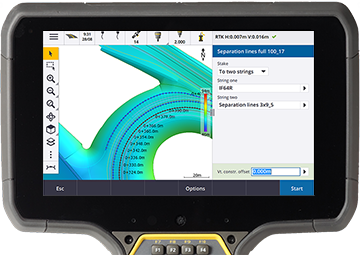
Measure or stake out points.
Trimble Access provides a wide range of methods for measuring points.
Fill out attributes for measured points and capture images as needed. See To enter attribute values when measuring a point.
Stake out points, lines, arcs, polylines, alignments or digital terrain models (DTMs). See Stakeout.
-
Review your data.
Use the Point Manager to view tabulated data point by point or Review job to view a summary of the points collected in the job. See Reviewing and editing job data.
-
Distribute your data.
Export data to different file formats for office processing or sharing with others, or generate reports. See Exporting data from the job.
Transfer the job or project to the office, or synchronize the data to the cloud.

These steps are explained in detail throughout the
